
GOJIRA
Geoglyph Observations through Jungle Imagery in Remote Amazonia

Previously unknown in the Amazon Basin, the enigmatic geoglyphs recently discovered across the southern rim of Amazonia are a testament to ancient indigenous social complexity and organization.
Along with an international team of collaborators, Terra Incognita seeks to uncover the full geographic distribution of the Amazonian geoglyphs, be the first team to ground truth results in the field, explore various interpretations of their significance, and develop an interactive web tool to share results and promote the preservation of these important archaeological sites.
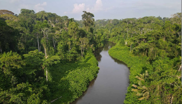
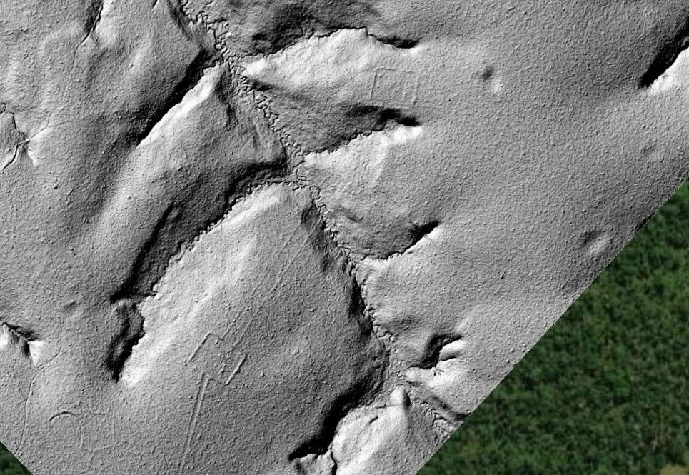
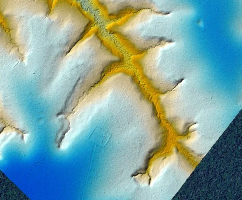
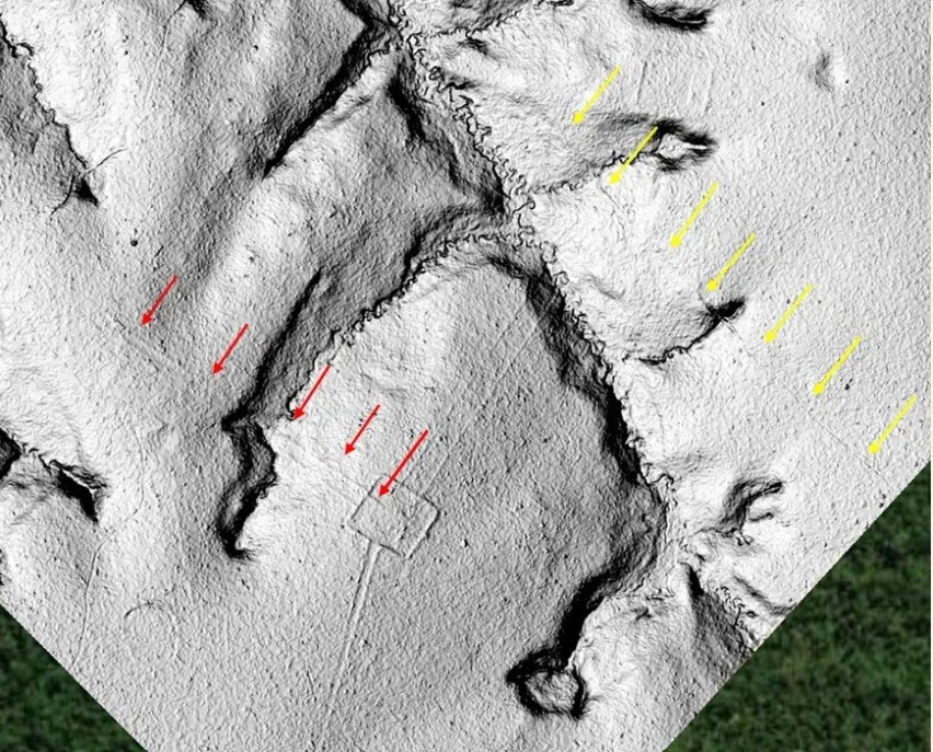
Geoglyphs are impressive earthworks constructed with ditches and mounds to create large geometric shapes and are often interconnected by ancient road networks (photo credit: Robert Walker.)
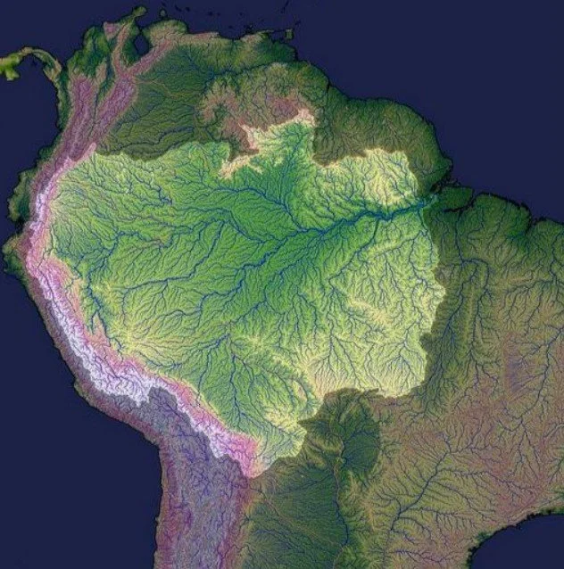
Amazon Basin
The Amazon Basin refers to all areas of South America that are drained by the Amazon River and its tributaries. The largest in the world, the Amazon drainage basin covers an area of approximately 7,000,000 km 2 (2,700,000 mi 2 ), or about 35.5 percent of the South American continent. It includes all or parts of Bolivia, Brazil, Colombia, Ecuador, Guiana, Peru, Suriname, and Venezuela, as well as the territory of French Guiana.
Previously, the Amazon was thought to be an eternal pristine rain forest inhabited by only hunter-gatherers. Because of this, archaeologists and others dismissed the possibility of large-scale society in the Amazon Basin. However, recent research suggests that the Amazon region may not have always been the dense rain forest that we know today.
New data suggest some areas of the Amazon may have been savanna rather than forest, and the people living there from 2,500 to 500 years ago were more likely farmers rather than solely hunter-gatherers.
“There are densely populated cities where were a pin to drop from the sky, it would land on the head of a person, never falling to the ground. ”
Lost City of “Z”
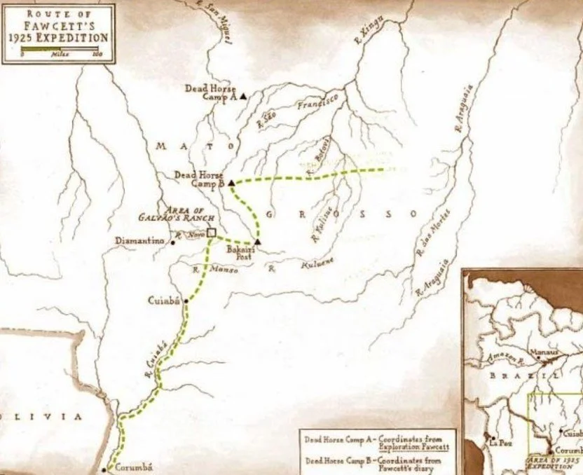
In 1925, famed explorer Percy Fawcett set out from Cuiabá, Brazil for his 7 th expedition into the heart of the Amazon jungle in search of the mythical Lost City of “Z”. Fawcett and his party were never heard from or seen again. To this day, Fawcett’s disappearance is one of the greatest mysteries in exploration history, and like Fawcett, "Z" remains lost.
El Dorado

The legend of El Dorado was first recorded in the 16th century by the Spanish. In their lore, they referred to the king as El Dorado, 'The Golden One', a name which eventually came to be applied to the city itself. According to legend, El Dorado was a great city of gold located somewhere in South America either along the Orinoco River or in Guiana. The king of this city was said to be so rich that he would cover himself from head to toe in gold dust. El Dorado remains known only in legend.
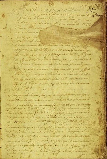
Manuscript 512
Manuscript 512 is a ten-page document discovered in 1839 at the National Library of Brazil. It recounts an expedition by Portuguese bandeirantes in 1753. According to the author, after ten years of traveling through Brazil's jungle, the explorers stumbled upon an abandoned "lost city." Like El Dorado and "Z", this lost city has yet to be relocated. The manuscript is one of the most famed documents of the National Library's collection and some Brazilian historians consider it "the greatest myth of national archaeology."
Over time, most researchers had come to the conclusion that no complex large-scale civilizations had ever lived within the Amazon during Antiquity. This was based upon available information regarding the rain forest chronology. Because of this, the general consensus has been that Fawcett and the other explorers were indeed chasing a mirage - a legend that never existed.
However, new developments in archaeology over the past decade have now called these presumptions into question, opening a whole new world of archaeological exploration and discovery.
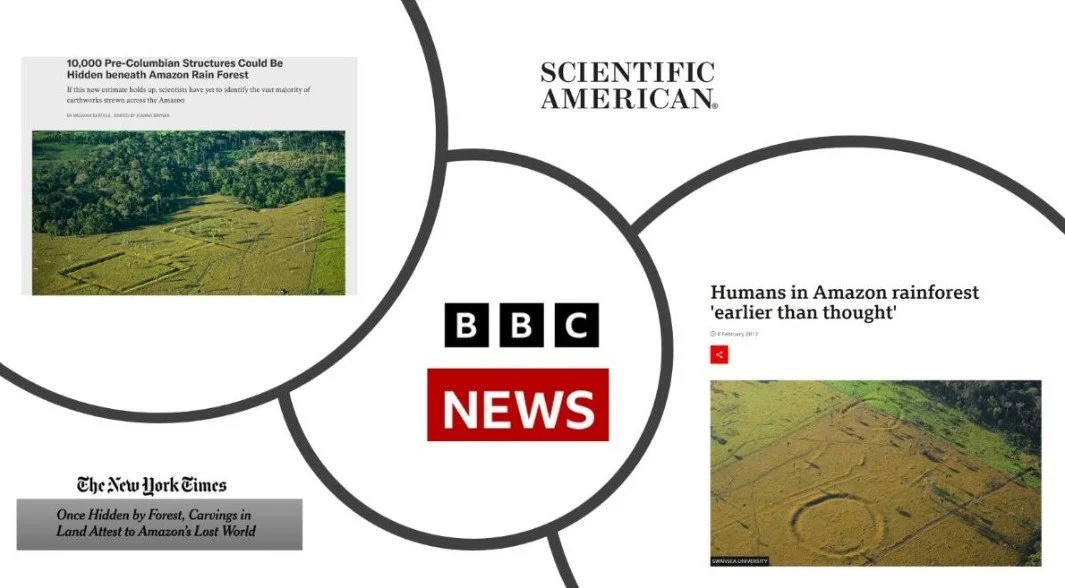
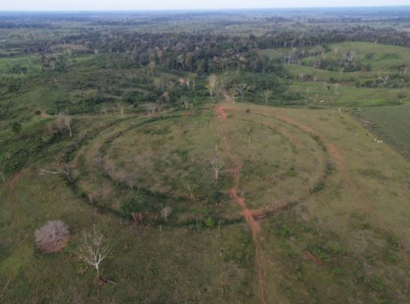
Years of deforestation in the southwest Amazon has revealed many large earthen geoglyphs (large man-made geometric earthen features, akin to the famed Nazca lines of Peru) throughout the region, providing evidence of large-scale permanent settlement.
Remote Sensing
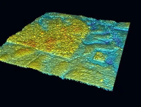
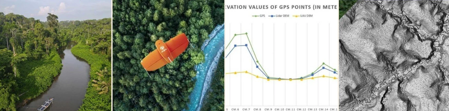
Remote sensing techniques such as LIDAR have helped make this possible by its ability to see through the shroud of dense jungle canopy by digitally peeling back the thick vegetation and tree cover to reveal the Earth’s surface below.
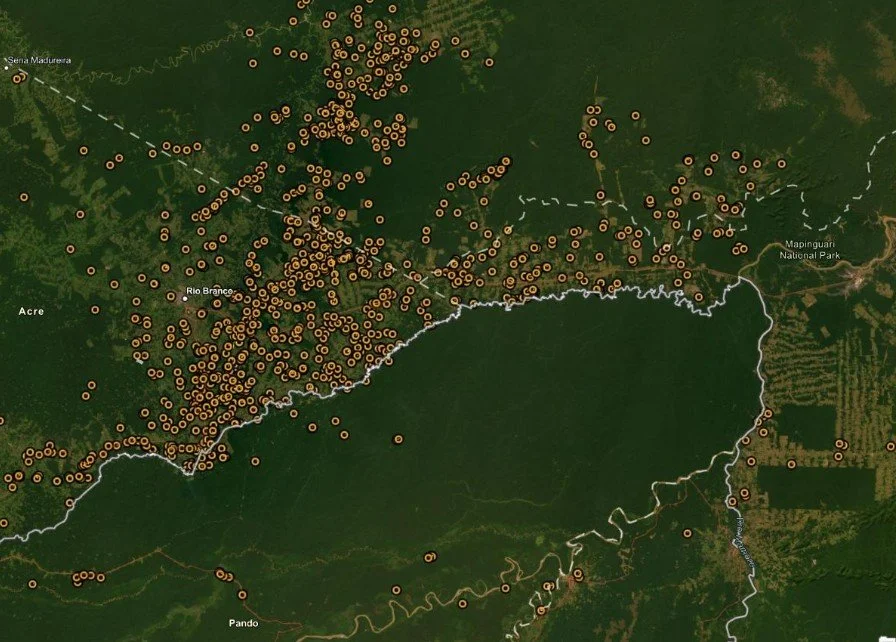
Of the more than 1000 earthen features that have been identified, almost all were found in deforested areas. Meanwhile, most of the forested areas have yet to be explored and LIDAR has rarely been utilized. This suggests that the geoglyphs that we do know of are not the only ones. Likely, they are far more abundant and are equally dense in forested areas.
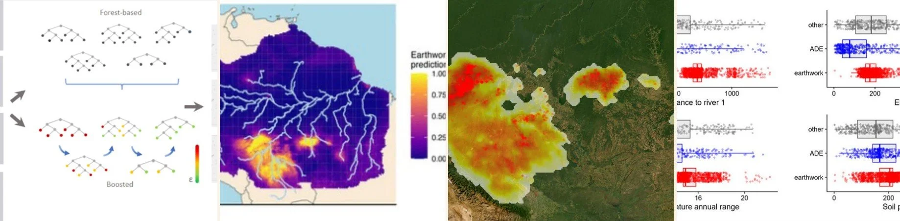
Consequently, experts have estimated that more than 90% of the geoglyphs have yet to be discovered. But even this number may be an understatement. Even in areas previously surveyed through LIDAR, Terra has identified new geoglyphs and features that were missed in the initial surveys by using more advanced processing techniques. This suggests that even in areas where others have searched, there may yet be hundreds if not thousands of additional earthen features that have escaped detection.
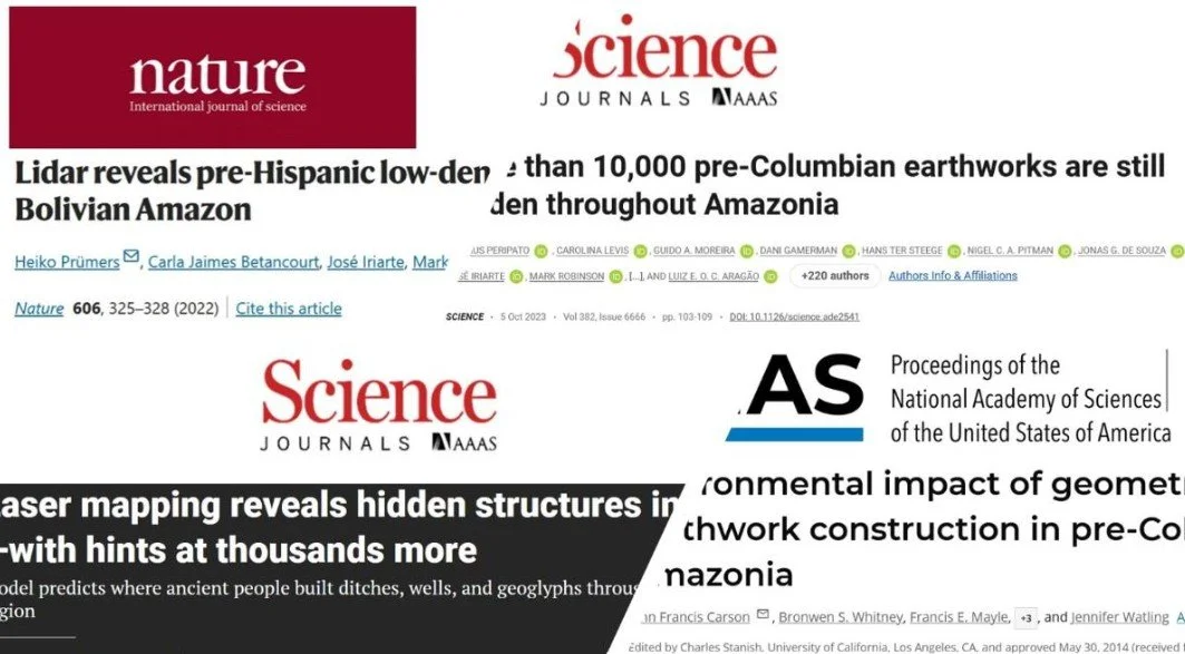
Although understudied compared to other regions of the world, Amazonia harbors early and abundant archaeological evidence for ancient social complexity and organization. This evidence includes monumental architecture (Prümers et al. 2022), garden cities (Heckenberger et al. 2003), road networks (Saunaluoma et al. 2021), earthworks (Pärssinen et al. 2020), raised fields (Rodrigues et al. 2018), and expansive anthropogenic soils (Woods & Denevan 2009).
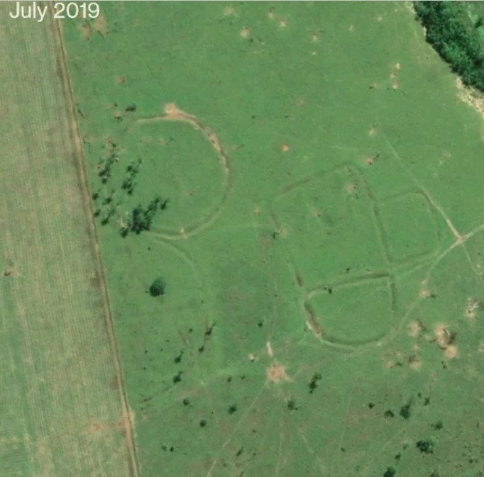
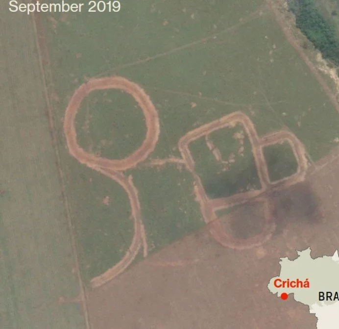
This research couldn't be more urgent. With the threat of deforestation all around, the preservation of these newly discovered archaeological features is critical. Numerous examples of destruction of these geoglyphs have already been documented through simple satellite imagery. Here, intensifying agricultural and urban development has degraded many geoglyphs over the last several decades.
Main Objectives

Stage One:
As part of this project we are first identifying, documenting, and analyzing geoglyphs using remote sensing techniques These methods will not only determine the geographic extent of geoglyphs in the Amazon, but the development of these protocols will be applicable for other large-scale archaeological search applications. In the end, these methods will assist in answering important questions about the full scope of Indigenous social complexity and landscape modification across Amazonia. This cutting-edge technology allows us to go well beyond the deforested areas and look deeper through the dense jungle to map and identify the evidence of ancient civilization below.
“There’s no way to know what’s down there until you get there, and when you get there you have problems trying to find and orientate the sites.”
Stage Two:
We will then head into the jungle itself on foot, setting up base camp deep within the Brazilian Amazon. There, we will physically explore each piece of evidence we gathered through Phase one, confirming our remote observations and identifications. As well as exploring the jungle off-trail and on-foot, we will extensively map new deeper areas of the jungle using drone borne LIDAR sensors.
“While the results of the lidar scans require on-site verification, their implications are profound.”
Stage Three:
The final stage is the recordation and modeling of all data, using state of the art computer technology. Using machine learning and AI to fully develop longitudinal remote surveillance that catalogs all known locations of geoglyphs and road networks can then be used to help policy makers make informed decisions that will increase protection of these important archaeological sites. The final product will be an interactive website to help guide interpretation and protection of geoglyphs.
“If we may find a city, where one was considered impossible to exist, it may well write a whole new chapter in human history”
Broader Impacts
The GOJIRA project promotes the recognition and protection of ancient indigenous cultural heritage and significantly contributes to the understanding pre-Columbian cultures as well as the peopling of the New World. Building a comprehensive database describing geoglyphs, their features, and environmental contexts is the crucial first step towards better understanding and preserving them. Native Amazonian societal development and ecosystem engineering techniques generated widely distributed urban networks that have only recently become more fully appreciated. Nonetheless, these impressive landscape legacies are only beginning to be studied. The problem is exacerbated by the fact that site locations and metadata are not easily accessible, even for experts. While making this data available to others, Terra Incognita will detect even more ancient geoglyphs and road networks through various remote and on-the-ground techniques, which will help answer the following questions:
· What is the full geographic distribution of geoglyphs, and how best can they be detected in forested areas?
· Are geoglyphs found only in certain locations or distributed broadly across the landscape?
· What were the functions of geoglyphs, and how much work did they take to create as estimated from 3D models?
In the year 2025, on this 100th anniversary of Percy Fawcett's final expedition, there couldn't be a more perfect moment than now to complete his mission of discovering lost civilizations in the Amazon. If successful, our project could radically alter our understanding of human history, proving irrefutable proof that advanced societies did indeed once thrive in the harsh Amazon.
