

GYSER
Geospatial Yellowstone Survey for Eruption Risk
A Living Volcano Beneath America’s First Park
Yellowstone is unlike any other place on Earth. Grazing bison, towering geysers, rainbow-colored hot springs, and steaming valleys filled with wildlife define the world’s first national park. But beneath this beauty lies something far more powerful: an active volcanic system, one of the largest on the planet.

Entrance to Yellowstone Park
The entire park sits within a vast caldera, its surface constantly reshaped by the immense forces below. In an instant, geysers can erupt, ground can heave upward, or hot springs can explode with no warning. These aren’t distant possibilities — they are part of Yellowstone’s living history.
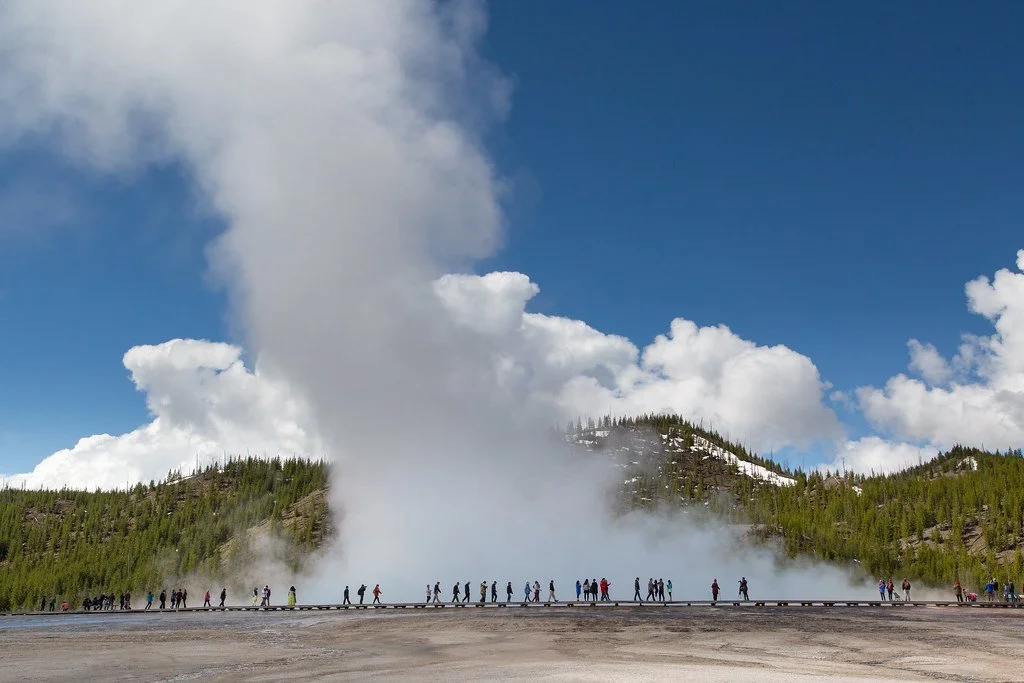
Park visitors enjoying the Grand Prismatic Spring, Yellowstone Park
The Hidden Problem
Yellowstone’s landscapes may look timeless, but they are anything but stable. In 2024, a sudden hydrothermal explosion at Biscuit Basin sent boiling water, rocks, and steam skyward — a dramatic reminder that these features can shift without warning. Earlier events, like the 1989 Porkchop Geyser explosion and the sudden uplift at Norris Geyser Basin in the 2000s, underscore the risks hidden beneath Yellowstone’s crust.

Biscuit basin prior to 2024 explosion

Biscuit Basin boardwalk following 2024 explosion
These natural events threaten not only the fragile ecosystems of the park, but also the millions of visitors who walk the boardwalks each year. But current monitoring tools, such as satellites and aircraft surveys, often lack the precision to catch the earliest warning signs. By the time changes are noticeable, it may already be too late.
Park Visitors at geothermal geyser, Yellowstone Park
Terra INCOGNITA’s Mission in Yellowstone
The GYSER Project is a collaboration between the Terra Incognita Research Institute and the Taylor Geospatial Institute at St. Louis University. Together, our team is bringing cutting-edge tools to Yellowstone’s dynamic thermal basins.
LiDAR produced image of Lone Star geyser
Using drones (UAVs) equipped with LiDAR scanners and high-resolution cameras, we are mapping Norris, Upper, Midway, and West Thumb geyser basins in extraordinary detail.
LiDAR works by firing millions of laser pulses that measure the ground surface with centimeter precision, even through steam and vegetation. Photogrammetry, meanwhile, uses hundreds of overlapping photos to reconstruct 3D models of the terrain.
Photogrammetry produced image of Lone Star geyser
By comparing our new ultra-high-resolution maps to older U.S. Geological Survey LiDAR data and through time-series data, we hope to detect even the smallest changes: a few centimeters of uplift, a new fracture in the ground, or subtle subsidence that could signal shifting geothermal pressure. These changes may hold the key to predicting dangerous hydrothermal events before they happen.
A New Era of Monitoring

Mammoth Springs (photogrammetry)
This project doesn’t exist in isolation. Around the world, UAV-based mapping has transformed how scientists study dangerous landscapes. In Iceland and Hawaii, drones track active lava flows in real time. In Central America, UAV LiDAR has revealed volcanic deformation invisible to the naked eye. Now, that same technology is being applied in Yellowstone — one of the most visited and geologically active regions on Earth. But this time, it’s in the service of detection of dangerous volcanic activity before it occurs.

Mammoth Springs (LiDAR)
Our work will help answer key questions:
Can we detect the earliest signs of hydrothermal explosions?
How do geysers and hot springs reshape the land between eruptions?
What patterns of uplift or subsidence warn us of hidden changes underground?
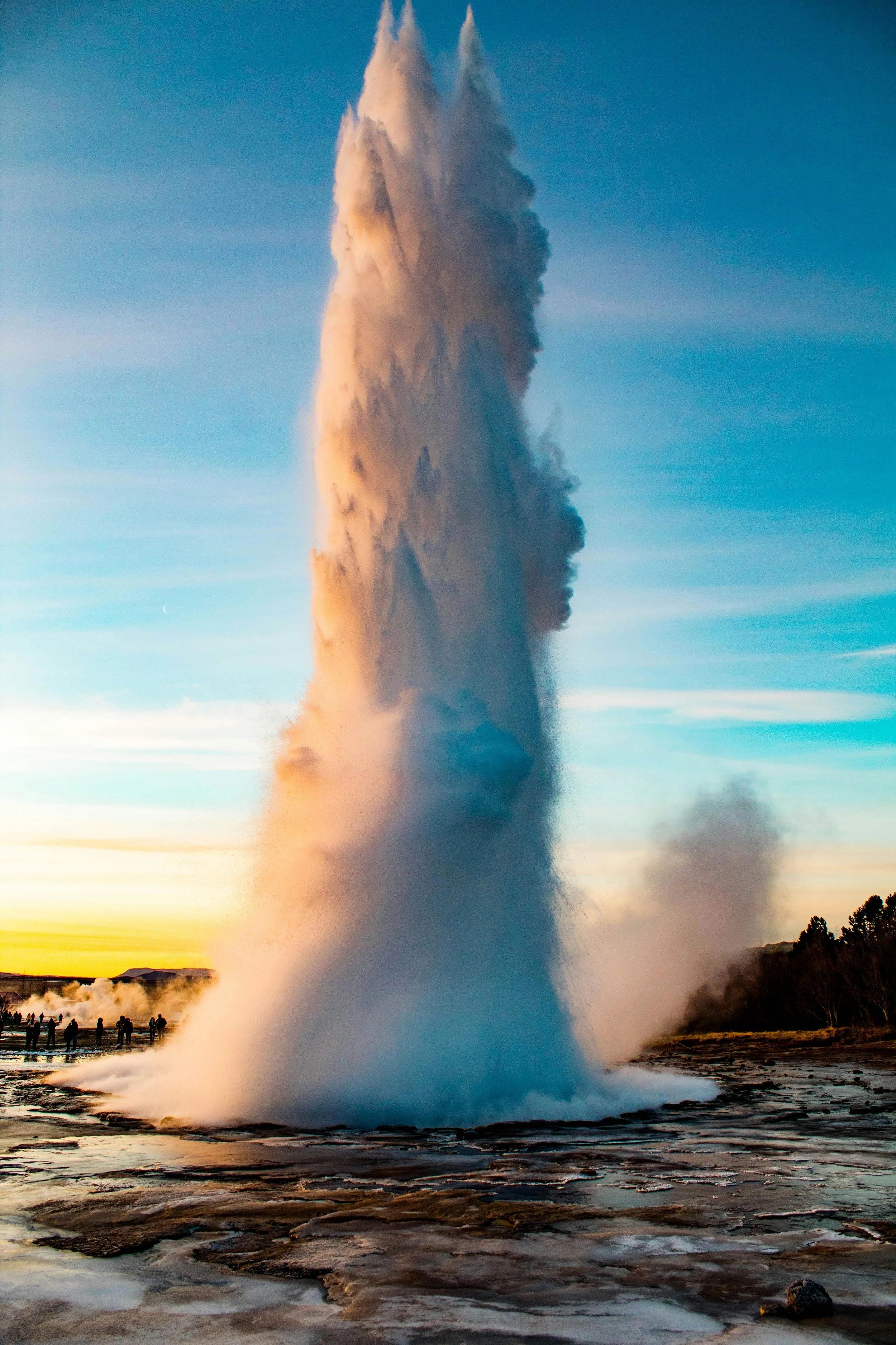
Old Faithful geyser, Yellowstone
Why It Matters
Every year, more than four million people visit Yellowstone. Families walk above thin geothermal crusts, often just feet from boiling pools and steaming vents. Rangers and park managers carry the responsibility of keeping them safe while protecting this fragile environment.

Biscuit Basin, Yellowstone
The GYSER Project doesn’t just advance science — it protects Yellowstone’s future. It aims to provide a powerful new tool: cost-effective, high-resolution monitoring that can inform hazard models, guide safe placement of boardwalks and trails, and deepen our scientific understanding of Yellowstone’s restless volcanic system.

Morning Glory pool, Upper geyser Basin, Yellowstone
Our work ensures that this extraordinary landscape remains both a place of wonder and a safe experience for generations to come.
Exploration. Innovation. Protection.
Yellowstone is a living laboratory, a place where fire and water meet beneath the Earth’s surface. The GYSER Project shines a light on those unseen forces — harnessing exploration and innovation to protect both people and wilderness.
AI generated recreation of Supervolcano eruption

“In the Yellowstone”
Harriet Monroe (1860-1936)
Little pin-prick geysers, spitting and sputtering;
Little foaming geysers, that spatter and cough;
Bubbling geysers, that gurgle out of the calyx of morning glory pools;
Laughing geysers, that dance in the sun, and spread their robes like lace over the rocks;
Raging geysers, that rush out of hell with a great noise, and blurt out vast dragon-gulps of steam, and, finishing, sink back wearily into darkness;
Glad geysers, nymphs of the sun, that rise, slim and nude, out of the hot dark earth, and stand poised in beauty a moment, veiling their brows and breasts in mist;
Winged geysers, spirits of fire, that rise tall and straight like a sequoia, and plume the sky with foam:
O wild choral fountains, forever singing and seething, forever boiling in deep places and leaping forth for bright moments into the air,
How do you like it up here? Why must you go back to the spirits of darkness? What do you tell them down there about your little glorious life in the sun